Skip to content
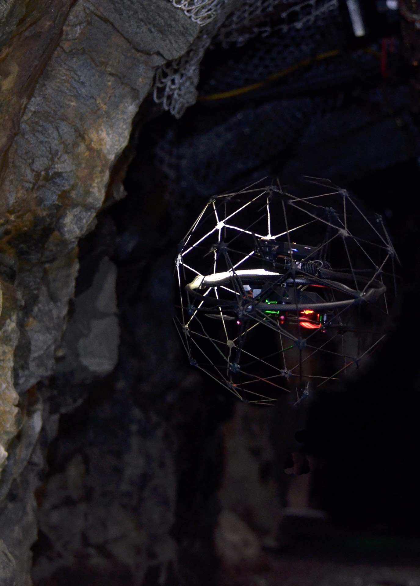
VISUAL INSPECTIONS
LOWER COSTS,
HIGHER SAFETY
Decrease downtime and reduce inspection costs, while increasing worker safety by remotely accessing Confined Spaces, Head Frames, Crushers, Brow Hang-Ups, Retired Workings and other complex environments or almost anywhere else you need to access within your Mines, Mill and Surface operations.

Photo courtesy of Flyability
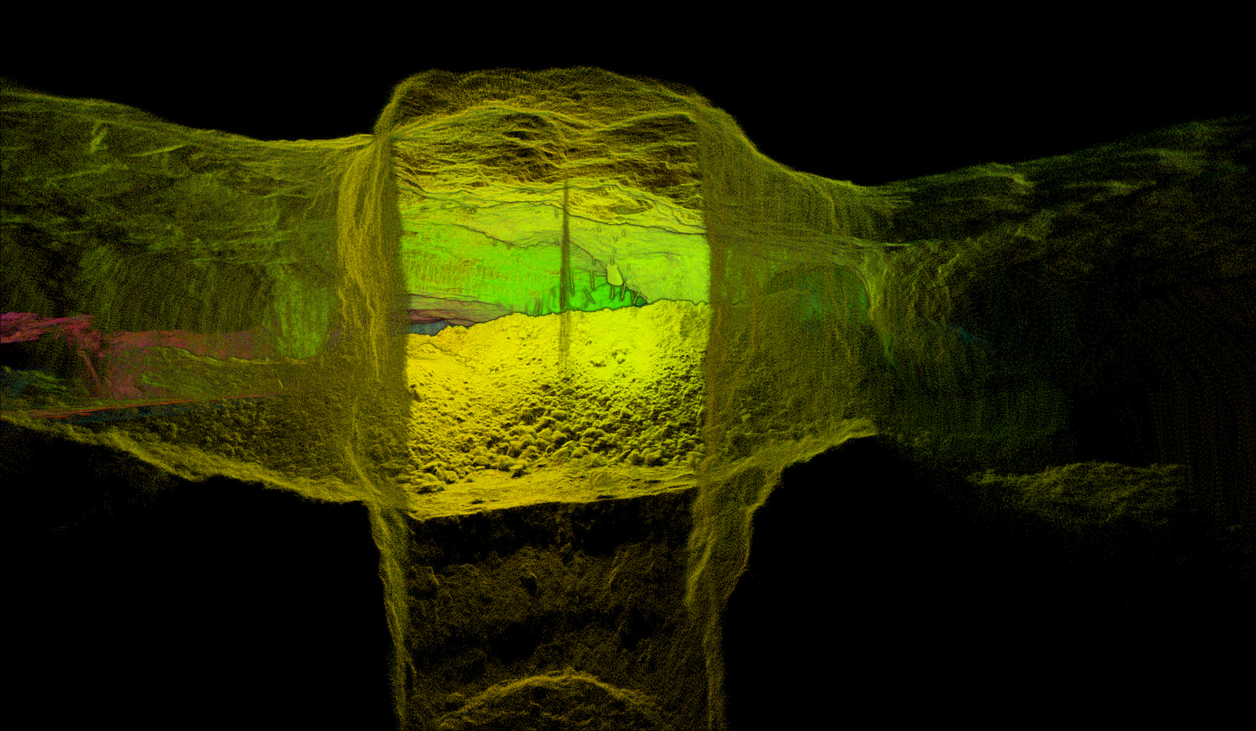
LASER CMS INSPECTIONS
HIGH RESOLUTION IMAGERY IN COMPLETE DARKNESS
LIDAR, which stands for Light Detection and Ranging, is a remote sensing method that uses light in the form of a pulsed laser to measure ranges (variable distances) to the Earth. These light pulses—combined with other data recorded by the airborne system— generate precise, three-dimensional information about the shape of the Earth and its surface characteristics.